
Development Update: Building the City Layer
A quick update on where things are heading. Three threads have had most of my attention lately: the new city-building layer, continued polish on the macro map, and working through the feedback you’ve been sending.
Descending into the city: “City Elements”
In The Road Ahead, I described the bigger vision behind National Transit — that it shouldn’t stop at connecting a nation from above. As cities grow on your macro map, you should be able to enter them and design them from the inside. That’s the large piece I’m building now.
The idea: once a city reaches a certain size, you can descend into it and build at street level — its roads, railways, rail transit (metro and tram), and bus routes — and develop the city itself: laying out residential, commercial, office, and industrial zones. As those zones fill in, companies and organizations appear and grow inside the city, and that activity in turn generates real transport demand. This is the intent behind what I’m calling City Elements.
To be honest about where it stands: in today’s macro-focused game, this layer can’t really show its value yet — the two halves aren’t fully wired together. But it’s coming along, and I wanted to share some in-development screenshots to make the concept concrete.
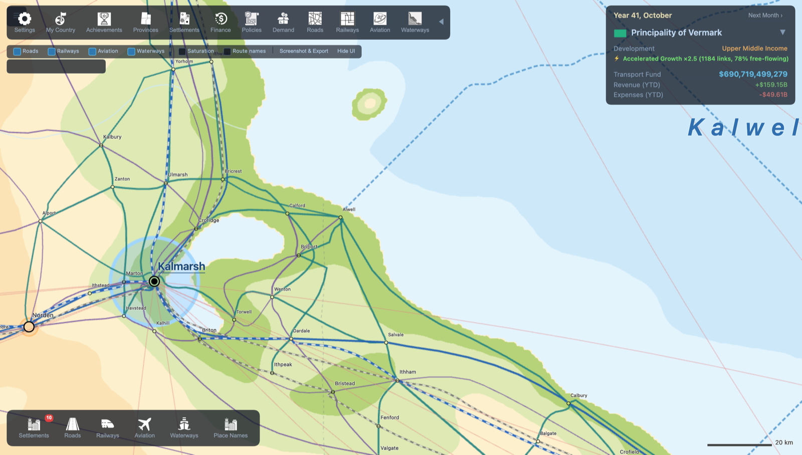 Where it connects: on the macro map you locate a city — here Kalmarsh, in the Principality of Vermark — and the plan is to descend into it directly from this view, so the street layer grows out of the national network you’ve already built. The blue circle around Kalmarsh marks its metropolitan area — the zone you can build the city within — and it expands as the city’s population grows.
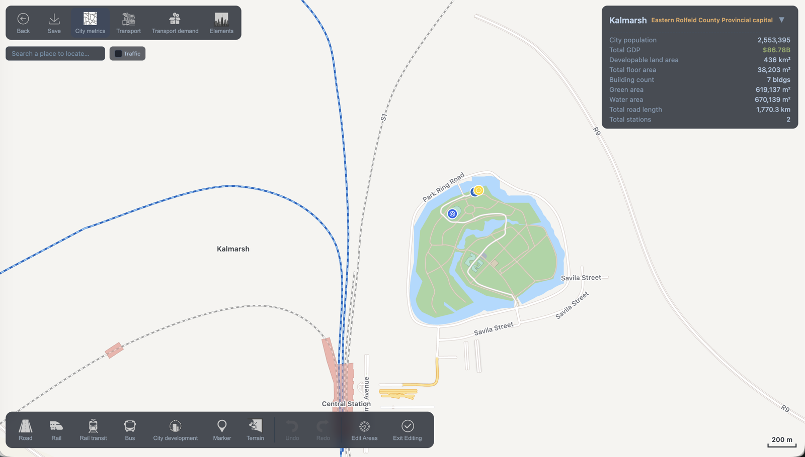 The same city at the street layer — a central station feeding into the urban network, with live city metrics (population, GDP, land use, road length) alongside.
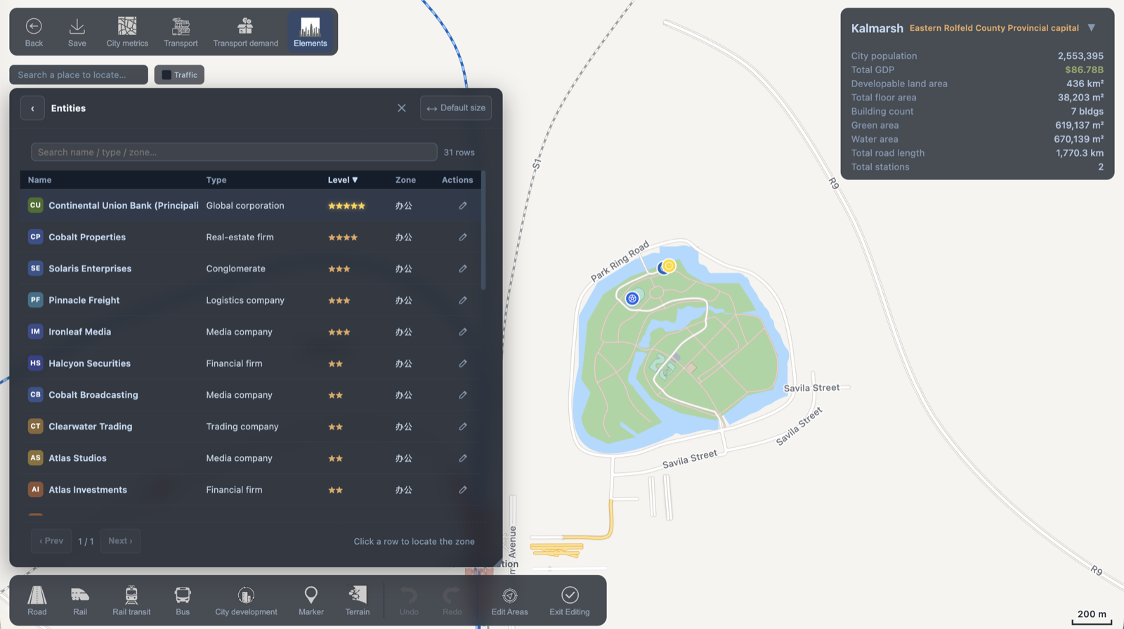 Inside Kalmarsh — the Entities panel: the companies and organizations (a global corporation, a real-estate firm, media companies, financial firms…) that emerge and grow as a city develops, each generating its own transport demand.
Polishing the macro map
Alongside the new layer, the existing macro game keeps getting refined. One recent addition is proper in-game screenshotting and map export — so you can capture your whole nation as a clean, shareable image (the “Screenshot & Export” button in the toolbar above).
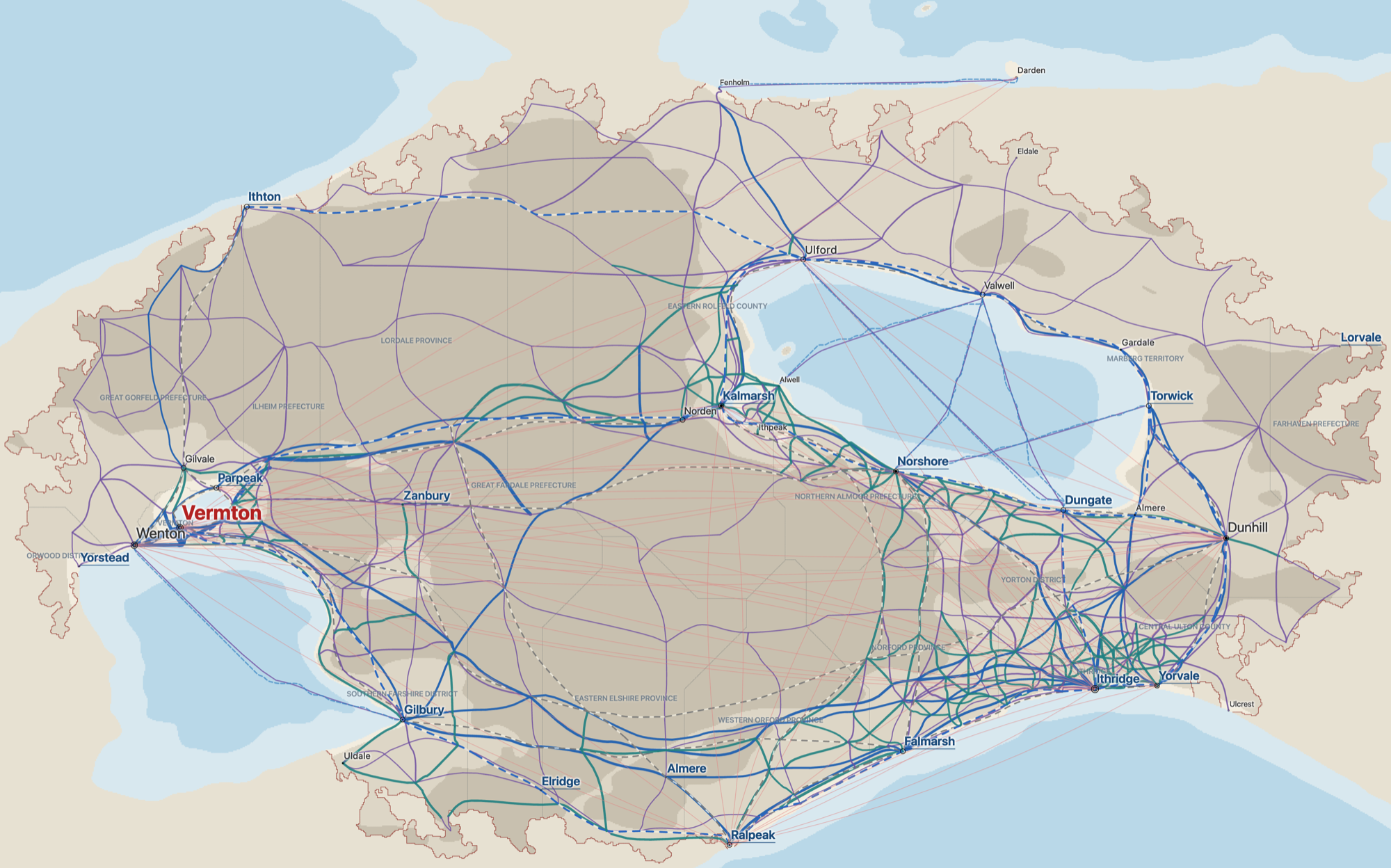 A full-nation map exported straight from the game — roads, railways, aviation, and waterways across the Principality of Vermark. Exactly the kind of image I hope you’ll want to share.
Listening to the community
Finally: since launch I’ve been collecting, evaluating, and acting on your feedback. Every bug report and suggestion goes into a list I work through, weigh, and fold into the roadmap — and a lot of what’s already shipped came directly from players who took the time to write in.
All of the above is actively in the works, and I’ll ship updates as soon as I can — rounding out the game’s content and improving the overall experience.
See you on the map.